CSU Team Launches Online Support Tool for African Forests
August 28, 2023
Joshua Zaffos

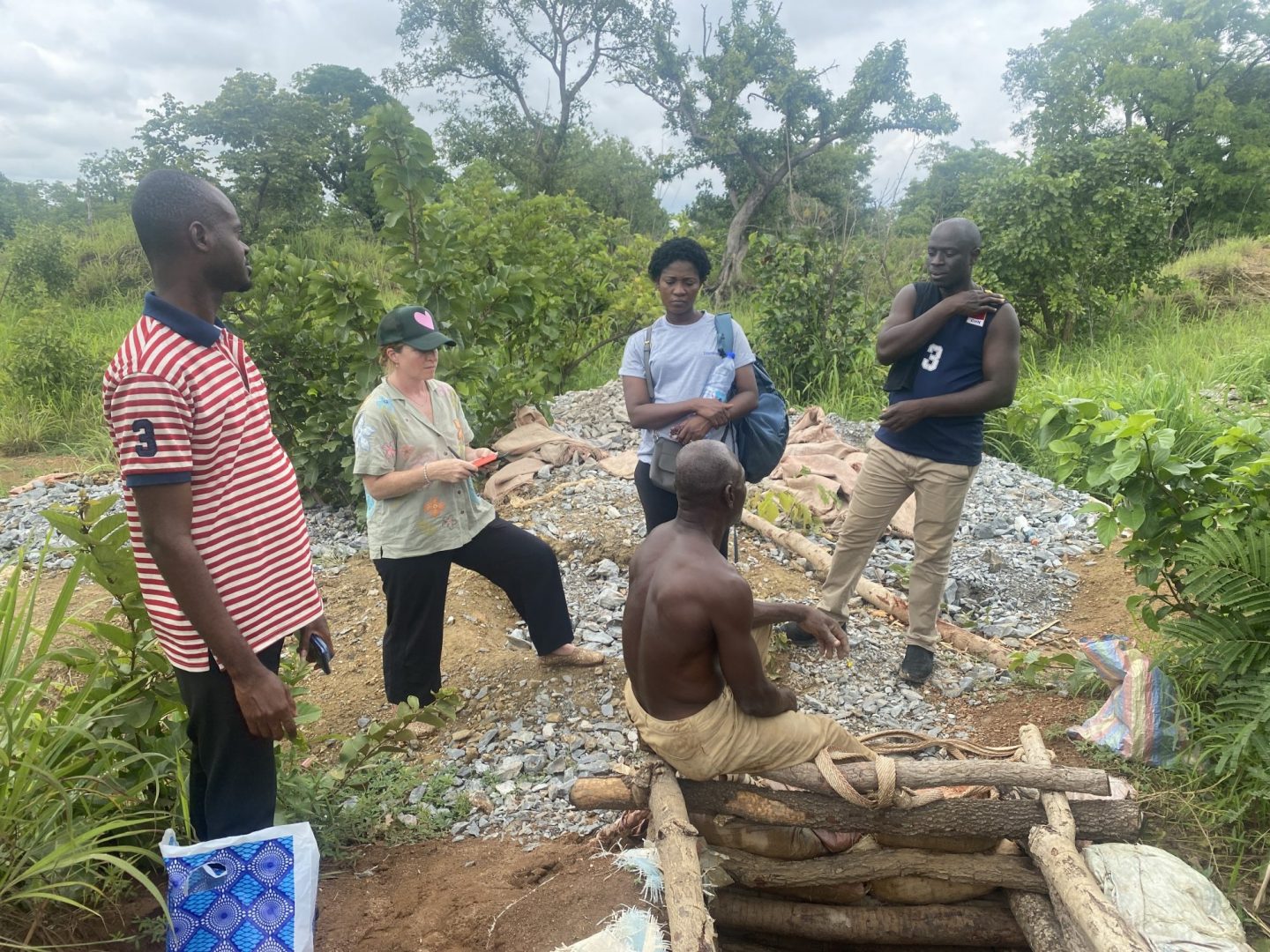
This June, a NASA-funded team of CSU researchers, including University Distinguished Professor of Anthropology and CSU Africa Center Director Kathleen Galvin, traveled to Kenya to unveil a new interactive, online tool to help land managers and foresters working in Kenyan and African forests. The CSU team — also including faculty from the Department of Atmospheric Science, the Department of Ecosystem Science and Sustainability, CSU Geospatial Centroid, and the School of Global Environmental Sustainability — collaborated with colleagues from the Kenya Forestry Research Institute (KEFRI) and the Stockholm Environment Institute (SEI Africa) to develop the Kenya Afforestation Decision Support Tool (DST). The user-friendly, interactive web app displays climate-change impacts and effects to forest cover and growth across different scenarios and will allow managers to better prepare for and adapt to actual climate changes.
The collaboration and new app support broader planning objectives in Kenya, where the government has initiated planting of 15 billion trees by 2032 to reduce greenhouse gas emissions, and to restore deforested and degraded landscapes.
“Knowing how trees might fare under different climate and disturbance scenarios with use of this decision support tool will help in planning for reforestation,” Galvin says.
Collaborating to Conserve Forests
More than 80 percent of people in rural communities in Kenya rely on forest resources and biomass for incomes, energy sources, and livelihoods. Forest products often supplement agricultural foods, and wildlife and livestock also rely on forests for habitat and space. But decades of deforestation and environmental change have diminished Kenyan forests. An ecological survey tallied less than 7 percent national forest cover in 2013, well below national benchmarks and United Nations recommendations.
Kenya’s planting initiative has begun to reverse that trend in the past decade, and the effort aims to reach 30 percent forest cover in the next decade. But reforestation and climate mitigation strategies will only succeed if managers have accurate and current data to be able to recognize near- and long-term climate and land-use trends.
Patrick Keys, Assistant Professor in the Department of Atmospheric Science — then a Research Scientist at the School of Global Environmental Sustainability — saw the changes and initiatives surrounding forest management in Kenya as an opportunity. In 2018, he teamed up with Galvin and Randall Boone, Professor in the Department of Ecosystem Science and Sustainability, to put forth a proposal through the Colorado Water Center to study and support sustainable forest management in Kenya.
“I wanted to put together a team that merged our expertise, thinking about how changes in forests might affect both the atmospheric water cycle as well as communities that depend on the land for their well-being,” Keys says. “It was critical for this project to have personnel from not just different departments, but also from various backgrounds, levels of experience, and expertise. The project would simply not have been possible without any one part of the team.”
The group won the Water Center funding and then expanded their vision and earned a three-year NASA grant in 2019 to continue their work. The team established relationships with KEFRI and SEI Africa leaders and then won additional funding to conceive and develop the decision-support tool, recognizing its utility for foresters, scientists, and managers in Kenya. Decision-support tools help in planning and management by harnessing spatial and field data and computer modeling to offer projections of different environmental and management outcomes.
“We asked our partners in Kenya, specifically KEFRI and SEI Africa, what would be helpful for decision-making with regard to these tree-planting ambitions,” Keys says. “The answer was better information about what climate change might do to affect the success or failure of trees and forests in different parts of the country. So, the web application that we’ve co-designed provides an intuitive look at how climate change might affect the success of trees across Kenya.”
Managing Forests? There’s an App for That
Climate modeling is — no surprise — technical and complex. Decision support tools and systems are valuable because they share data to stakeholders via a user-friendly interface, says Caitlin Mothes, Research and Program Coordinator for the CSU Geospatial Centroid, who led the development of the DST app. The web-based tool “transforms raw numbers into decision-relevant summaries, visualizations and reports,” Mothes says, providing findings in a way that makes it easiest to incorporate data into decision-making processes.
No less important than the user experience is ensuring that DSTs run on the best data and most appropriate modeling. Postdoctoral researcher Rehka Warrier, Ph.D., led the climate-change analysis and ecological modeling for the program, acquiring forest-cover and climate datasets for Kenya and then determining an existing ecosystem model program that could effectively simulate Kenya’s climate futures. Since Kenya is a country dominated by savannas with relatively small patches of forests, modeling how forest cover might change or encroach on grasslands under different climate scenarios is that much more challenging, Warrier says.
While the COVID-19 pandemic hindered plans to engage and collaborate with Kenyan land managers and officials on the ground, that time proved useful for Warrier and Mothes to, respectively, fine-tune the modeling and develop the decision support tool into an accessible and easy-to-use web application. When the CSU researchers finally traveled as a group to Kenya this June, they were able to roll out the app at a workshop and training.
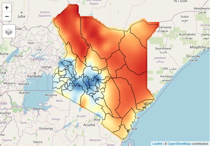
The beta version of the Kenya Afforestation DST allows users to model and “visually explore” different climate futures, ranging from optimistic to extreme pessimistic scenarios through the year 2100. The tool projects data across different “ecological scenarios” that represent various levels of forest cover, temperature ranges, and fire risks. The data is presented to users via interactive maps, as well as downloadable, summary reports.
“The DST is a tool that allows Kenyan forestry practitioners and policy makers to visualize how trees are likely to fare under dramatically different future temperature and precipitation conditions,” Warrier says. “We did not envisage DST as a tool that identifies areas where trees should or should not be planted. Instead, we intend it as a tool that allows forest managers in Kenya to appreciate the dynamic nature of vegetation across Kenya’s landscapes and how climate change modulates this dynamism.”
“Users can view and interact with the spatial distribution of predicted climate-related changes across the entire country, which I felt was a unique aspect to many of our participants,” Mothes adds. “Also, the fact that it is an open-source, web-based tool means Kenya foresters, land managers, and any other stakeholders can easily share this tool and its information among colleagues and other interested parties.”

Workshop Success and What Comes Next
A post-workshop survey showed that 100 percent of the workshop participants said they were likely to use the application in their professional activities.
“Workshop participants, mostly agency scientists and academics, were really interested, insightful, and engaged in the potential of the DST,” Galvin says. “The workshop was high energy and the atmosphere was very positive. It was a pleasure working with the group.”
Mothes echoed that sentiment. “I think quite often these kinds of tools are built but don’t quite reach their intended users to really make a difference in some decision-making process,” she says, “whereas we got to carry out a hands-on, in-person workshop for people that showed so much interest and excitement to use it.
“This was an extremely rewarding trip with really positive outcomes.”
The CSU research group fulfilled the NASA grant work with the support-tool demonstration this summer. Keys says there is interest from KEFRI and other partners to expand the app’s modeling capabilities, datasets, and focus area, leading the team to now pursue more NASA funding.
“This would be very exciting, not least because it would permit an actual demonstration of the concept of ‘science-to-policy,’” says Keys. “The CSU team has built exceptional partnerships with our in-country partners, and we now have other expanded collaborations that we’re discussing. It’s hard to say what comes next, but we’ve got lots of ideas.”